Enugu
Since the 17th century the location of present-day Enugu has been inhabited by the Enugwu-Ngwo and Nike subgroup of the Igbo people;. In 1900, the Southern Nigeria Protectorate was established by the colonial administration of the British Empire. The discovery of coal by the colonists led to the creation of what was then known as the Enugu Coal Camp, named after the nearby village of Enugu Ngwo, under which coal was first found. The nearby city of Port Harcourt was created for the purpose of shipping this coal abroad, being located 151 mi south of the camp. Coal mining opportunities in Enugu attracted people from throughout the region; this marked the core of the first urban settlement of what is today known as simply Enugu. Enugu developed as one of the few cities in West Africa created entirely from European contact. By 1958 Enugu had over 8,000 coal miners. there are no significant coal mining activities left in the city.
Enugu became the capital of the Eastern Region after Nigeria's independence in 1960; a succession of territorial adjustments in 1967, 1976 and 1991 led to Enugu becoming the capital of what is now Enugu State. On 30 May 1967 Enugu was declared the capital of the short-lived Republic of Biafra; for this Enugu is known as the "capital of Igboland." After Enugu was captured by the Nigerian armed forces, the Biafran capital was moved to Umuahia.
Industries in the city include the urban market and bottling industries. Enugu is also one of the primary filming locations for directors of the Nigerian movie industry, dubbed "Nollywood". Enugu's main airport is the Akanu Ibiam International Airport.
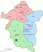
The 2006 national census in Nigeria estimated the population of Enugu state at 3,267.837, While the males constitute 48.84%, the female population constitute 51.16% (1,596,042-males and 1,671,795- females). Demographers have however indicated that the actual population of Enugu state is around 6 million .Enugu state has three senatorial zones namely; Enugu north, Enugu East and Enugu West
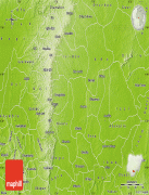
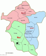
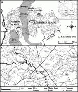
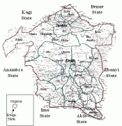
Map - Enugu
Map


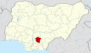


Country - Nigeria
 |
 |
| Flag of Nigeria | |
Nigeria has been home to several indigenous pre-colonial states and kingdoms since the second millennium BC, with the Nok civilization in the 15th century BC, marking the first internal unification in the country. The modern state originated with British colonialization in the 19th century, taking its present territorial shape with the merging of the Southern Nigeria Protectorate and Northern Nigeria Protectorate in 1914 by Lord Lugard. The British set up administrative and legal structures while practising indirect rule through traditional chiefdoms in the Nigeria region. Nigeria became a formally independent federation on 1 October 1960. It experienced a civil war from 1967 to 1970, followed by a succession of military dictatorships and democratically elected civilian governments until achieving a stable democracy in the 1999 presidential election. The 2015 general election was the first time an incumbent president failed to be re-elected.
Currency / Language
| ISO | Currency | Symbol | Significant figures |
|---|---|---|---|
| NGN | Nigerian naira | ₦ | 2 |
| ISO | Language |
|---|---|
| EN | English language |
| HA | Hausa language |
| IG | Igbo language |
| YO | Yoruba language |